Checks before and after a passage
Document checks before departure and after your return. Keep checklists together, record findings and follow up what needs doing before the next trip.

FOR EVERYONE WITH AN INTEREST IN THE SEA
Documents, practical tools and useful sources for everyone with an interest in boats and life at sea. Find what you need before a passage, on the water and when looking after your boat.
Explore documents and toolsOpen to everyone · Norwegian and EnglishOur visionSun on deck. Calm water. And a folder that could use a little more order.
We’re building Vesdoc to bring your boat’s paperwork, equipment and follow-up together.
AI-generated illustrative images.We’re developing a complete safety management system for small boats, bringing documents and practical tools together around each vessel. From checks before departure and documents on board to follow-up after a passage, operation and maintenance, Vesdoc will make life with your boat simpler, whether it is a retreat or a workplace.
More time for the passage, your guests and life on the water. Less time searching for paperwork.
Document checks before departure and after your return. Keep checklists together, record findings and follow up what needs doing before the next trip.
See which documents are needed for your boat and passage, and check that they are available on board throughout the trip. Keep relevant logs and your own notes, suited to how you use the boat and your routines.
One database for important boat documents: manuals, insurance, certificates, agreements, service records and history. Find the right document when you need it.
Keep service tasks, intervals, completed work and the next actions together. See what has been done, what is coming up and which equipment each task concerns.
Choose a simple overview of your boat’s income and expenses, with receipts and supporting documents linked to the right vessel. Track fuel, equipment, servicing and other running costs.
Keep track of parts, equipment and how everything fits together. Link manuals and history to what is actually fitted or carried on your boat, and find the information that meets your needs.
Documents, equipment and history organised around your own boat.
Explore the conceptSimpler handovers, clear agreements and a guide guests can return to.
Explore the conceptA shared overview of boats, documents and work that needs attention.
Explore the conceptBetter preparation and clearer information for guests on the water.
Explore the conceptKeep your boat and fishing equipment organised, with sea resources close at hand.
Explore the conceptTurn a pile of manuals into clear tasks for your particular boat.
Explore the conceptWe want to make it easier to identify the Norwegian and international requirements that apply to your boat, how you use it and the waters you navigate, organise the evidence and follow up checks. The plan is practical compliance support, with clear sources, checklists and an overview of what is in place and what remains to be done.
For tourist boats and small operators, our plans include safety management tools and printable passage packs. Legal requirements, the operator’s own routines and optional aids will be clearly distinguished.
Documents, navigation tools, maritime terms and links to weather and sea resources.
Your boat’s document archive, equipment overview and a guide accessed by QR.
Support for rentals and small operators, passage packs and local boating communities.
We’re building step by step and would love to hear what would make your boating life easier.
Printable A4 sheets with diagrams, formulas and calculation space. Choose your page language at the top; the PDFs follow your choice.
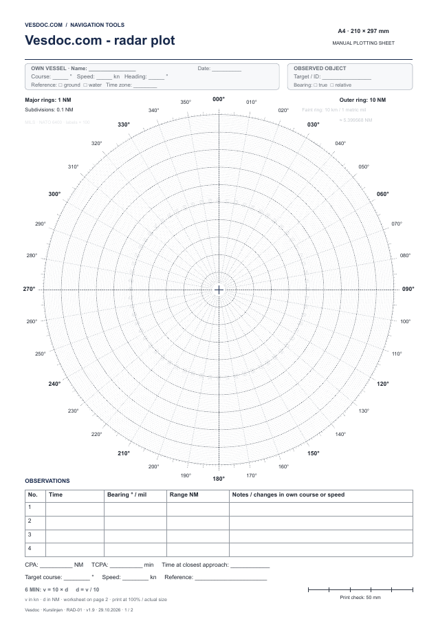
360° and 10 nautical miles. Observation table, six-minute plotting, CPA and TCPA. A faint ring marks 10 km from the centre.
Download PDF88 KBNorsk PDF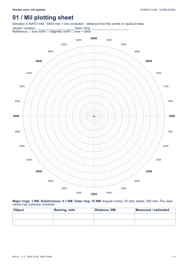
NATO 6400, graphical range calculator, field ruler and worksheets. Estimate distance and size using known dimensions ashore.
Download PDF109 KBNorsk PDFPrint at actual size (100%). The check line on the sheet should measure 50 mm.
Make sense of the labels on your chartplotter. Find the full English term, a plain explanation and its Norwegian equivalent.
Explore the glossary →Direct links to the source services. Our first collection covers the Norwegian coast. Each provider shows its own data and update times.
The Norwegian Mapping Authority’s English introduction to its pilot guide, with access to sailing directions and the map service.
KartverketChart correctionsCorrections to Norwegian charts and temporary and preliminary notices.
KartverketTidesHigh and low tides, observed water levels and forecasts for your location.
KartverketPassage planningMap-based information for planning boat trips.
BarentsWatch / KystverketWavesWave height, period and direction along the Norwegian coast.
BarentsWatch / KystverketCurrentsForecast speed and direction in Saltstraumen over the next two days.
BarentsWatch / KystverketVessel trafficPublic AIS vessel positions in Norwegian waters.
KystverketWeather & currentsSearch a place or coordinates. The coast tab includes waves, currents and sea temperature.
Yr / MET og NRKExternal links use providers’ English entry pages.
We’re also building your boat archive: documents, equipment, maintenance and history that travel with the boat. Join the list to hear when this part opens.
A tool, a document, or an easier way to get something done? Share your idea with us.